A Walk in the Park – Day 1
Monday, August 27, 2007; Day 1 - At last this day has finally come. We all arrived at Steve’s house in Tacoma at about 9:00 AM to complete our packing and head to Mt Rainier. In addition to the team: Grace, Christina, Katie, Steve, Fred and me (aka Dad or Ofa); we were accompanied by Kathy (aka Mom or Nana) and Arlene (Fred's wonderful wife) who were taking Elizabeth, Stephen and Seamus (aka the Monkeys) on a NanaCamp adventure.
We stuffed and crammed and squeezed to get the last of our gear into our packs. Fred and I had the most problem with our sleeping bags. Finally we were ready to load up the cars. That became another issue; how were we going to get all this stuff and 6 climbers into 2 cars. The Buchanan packing gene took over and in a few minutes Grace, Christina and Katie had the problem solved. Somehow Fred was able to squeeze into the back seat of Steve’s Kia. The NanaCamp crew had a roomy van but then again there were 3 kids and the noise level probably compensated for their roominess.
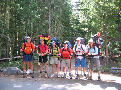
We headed east to enter the park at the White River entrance. Along the way we stopped for lunch at a super market; really good sandwiches, cold drinks, picnic tables, clean restroom at a nearby McDonalds and other last minute supplies. We could see the summit as we grew nearer and it grew bigger and higher. I recall the emotional high I experienced in July when Steve, Matt and I approached the Mountain to do a short climb to the Muir Snowfields. This high was no less. Our first stop was to sign-in with the Park Ranger, get our permits to go above 10,000 ft. and the unique experience of picking up our blue bags. See the picture of the proud climbers holding their blue bags (empty) with Mt R in the background. Oh, perhaps I need to point out that the blue bags are for “human waste”; the rule is that you take only memories and leave only footprints…. We still had a few miles to drive to our stepping off point at White River Campground.
You could feel the anticipation mount when we started to unload the cars and make final preparations. NanaCamp was in full swing with the kids using our hiking poles to walk across logs. We donned our socks (liners and hiking), boots, affixed our ice axes and trail flags to our packs, lathered up with sun screen and posed for pictures. The moment was finally here. We were at 4320 ft elevation and our first day goal was 3.1 miles up the trail. Fred and I tried to pick up Steve’s pack… it was really heavy. We all helped each other get our pack up and on and tightened. Fred wisely had set his pack on a picnic table that probably made it easier to get on, but it was also 30 ft farther from the trail. After final hugs we set off for our walk in the park.
In preparation for the climb I had been walking stairs and hills with a 45 lb pack (rocks) and it didn’t take long to realize that this pack was heavier. I didn’t know how much heavier and I didn’t want to know. One thing was sure, the more we ate, the lighter it would get. At the 2.4 mile point we took a rest, see photos with amusing captions on the blog. This was a good opportunity to adjust our packs and thanks to Grace, learn the proper sequence of putting them on and tightening the various straps. It certainly made a difference – thanks Grace.
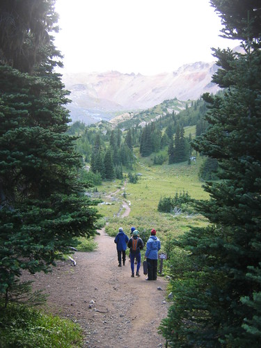
The trail is really nice and we would highly recommend it for day hikers. It follows the White River to its source at the base of Inter Glacier. There are sections of the trail that have been washed out by spring flooding, and beautiful dense wooded areas with tall stands as well as trees felled by snow and flooding. The end of the maintained trail is at Glacier Basin Camp, 5975 ft elevation. Though the hike was long it certainly didn’t seem like we gained 1655 ft in elevation. Just beyond our camp is a beautiful meadow with spectacular views of Sunrise (NanaCamp destination), the Inter Glacier and the summit. Grace took some great videos, hope you enjoy them.
At this point I think we qualified as hikers; tomorrow we would get our first real taste of mountaineering.
Here's a link to the route we took on Day 1 on mapmyrun.com. At the bottom of the map click "Topo" or "Satellite" for a better look at the route and "Show Elevation" to see more detail of the route.
Also, I've taken the liberty of pulling links for photos and video of our trip from the BuchananRainierTrip blog, and Grace & Fred's photos posted on Flikr.


No comments:
Post a Comment